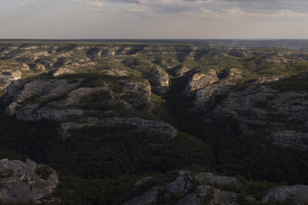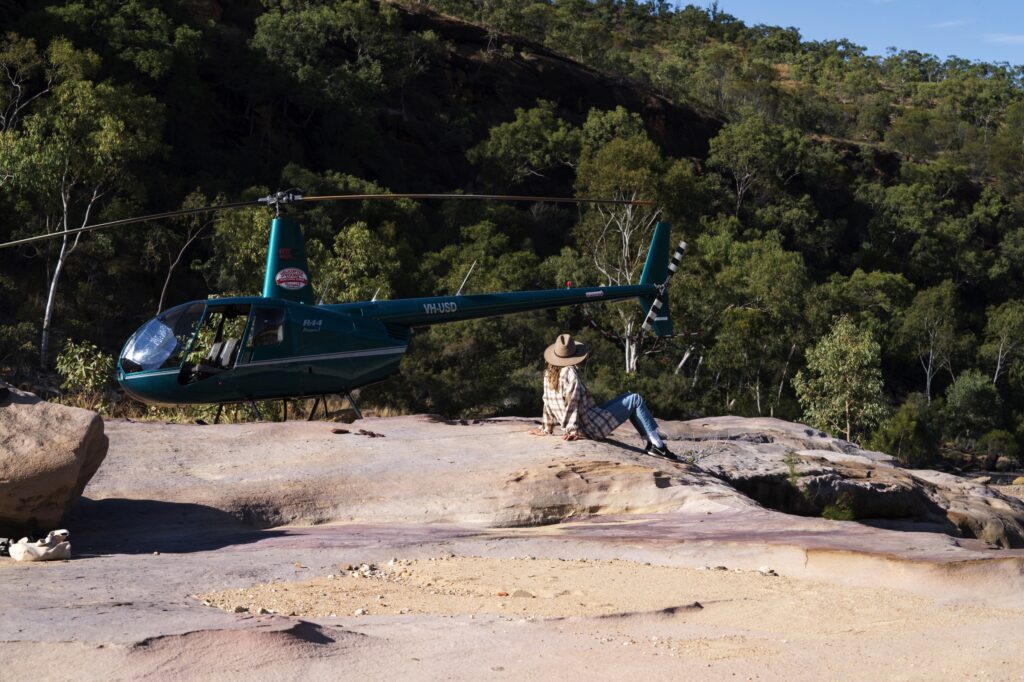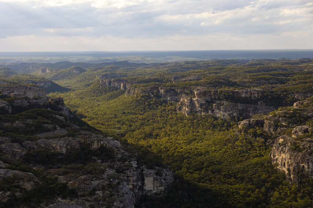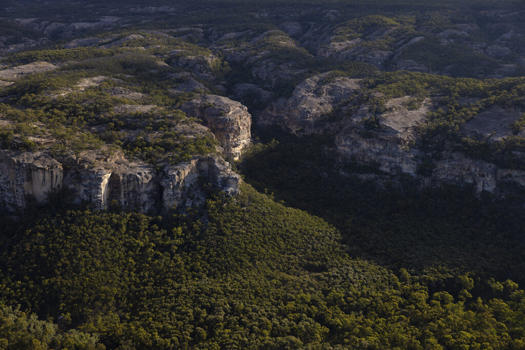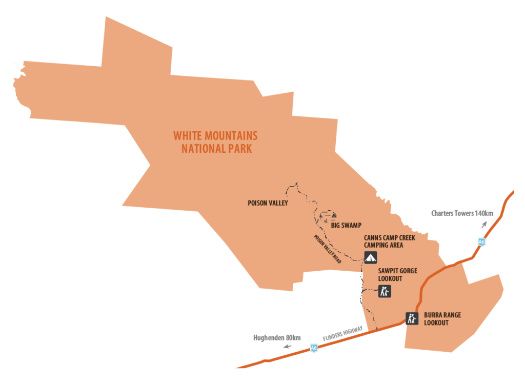
White Mountains National Park is characterised by white sandstone formations and complex gorge systems that cover 112,000 ha of rugged terrain. For much of the year this vast area is an arid landscape but during the wet season it becomes a water catchment for streams and rivers which eventually feed into Lake Eyre in South Australia and the Gulf of Carpentaria. Encompassing a total of 14 different ecosystems, winter and early spring transform the landscape as the native plants bloom into a palette of colour. White Mountains National Park is very remote and undeveloped and is only suitable for well equipped, experienced bushwalkers and campers. Access is from the Flinders Highway 107 km east of Hughenden or 140 km south-west of Charters Towers. Camp site bookings are available by phone or online, or at the Flinders Discovery Centre.
Getting there
The park turnoff is approximately 106km north-east of Hughenden and 140km south-west of Charters Towers, on the fully sealed Flinders Highway. For directions to the park entrance see “Location”.
Burra Range lookout is on the highway and is accessible to all conventional vehicles.
The access road to Canns Camp Creek camping area, when dry, is accessible to all high clearance vehicle types with care. It is accessible for camper trailers but not caravans or buses. During the wet season, between November and April, ( the road can be closed) and occasionally at other times, the road may be boggy and inaccessible.
Park features
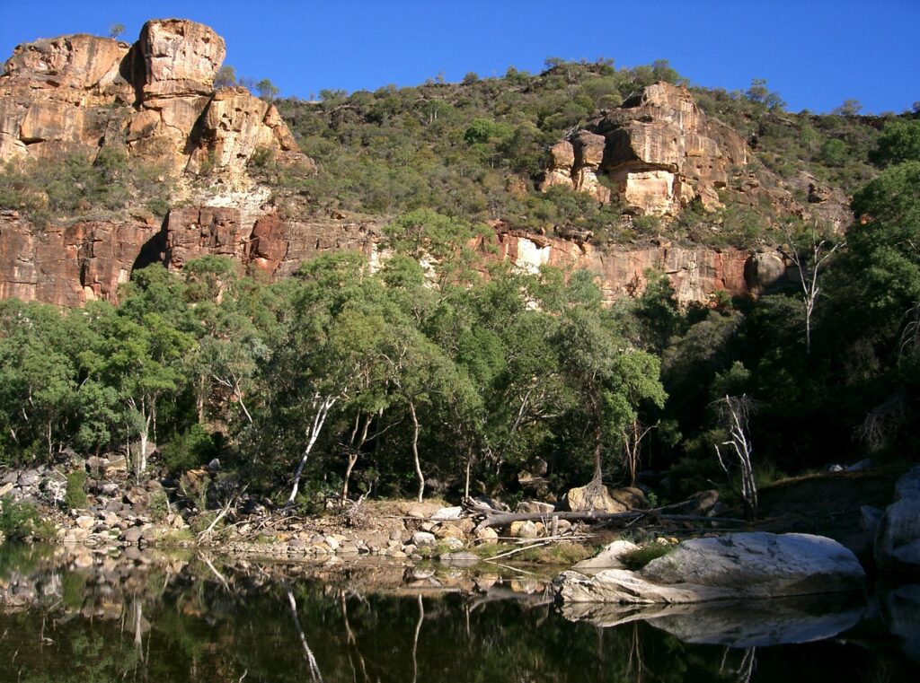
Covering an area of 112,000ha, this rugged wilderness park features spectacular white sandstone bluffs and gorges, and diverse plants and animals. A further 12,000ha are contained in the resources reserve on the eastern side of the park.
The park protects a total of 14 different ecosystems within the Desert Uplands Bioregion, making it one of inland Queensland’s most botanically diverse parks. Lancewood forests, open woodlands, laterite pastures, heathlands and spinifex grasslands are found around the white sandstone outcrops, white sand dunes and sandy flats occur in the Canns Camp area. Brilliant wildflowers and a host of animals can be spotted throughout the park.
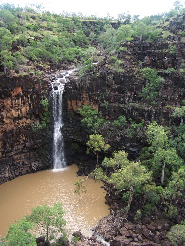
A vast arid landscape for most of the year, the park is transformed in the wet season, when streams come alive with the deluge of rainwater. The park contains the headwaters of streams flowing into three major catchment areas. Waters flow through several smaller streams into the Burdekin River and then to the east coast. The Flinders River flows north into the Gulf of Carpentaria. Water also flows through the channel country of western Queensland, eventually feeding into Lake Eyre in South Australia. White Mountains National Park is a major infill area for the Great Artesian Basin.
Natural Environment
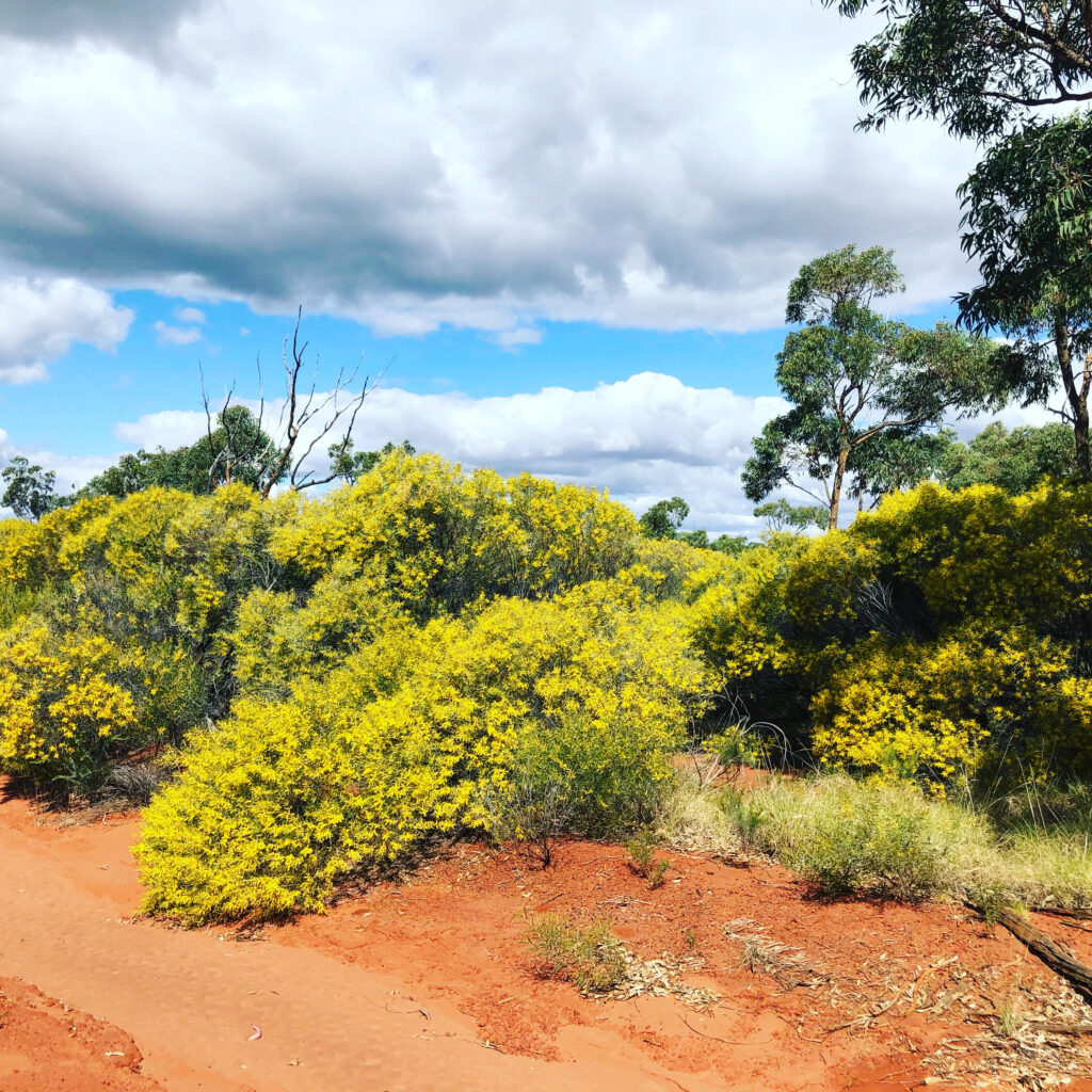
During winter and early spring, the park is transformed as native plants of all shapes, sizes and colours bloom across the landscape. You can see golden-orange, cream and red grevilleas together with wattles of all shades of yellow and the white clustered flowers of the ironbarks. It is rare to see such diversity and colour within the borders of one national park.
Plants and animals
White Mountains National Park is one of Queensland’s most botanically diverse parks, encompassing 14 regional ecosystems including two classed as endangered. Approximately 430 plant species contained in 10 vegetation communities have been identified on the park. Eucalypt, acacia and melaleuca woodlands, and a mass of heathland species dominate the vegetation.
About 30 plant species, normally affiliated to southern Queensland, have also been recorded in the park. White Mountains National Park is the northern extremity of their range.
The park is a haven for a variety of wildlife, especially reptiles, which are well suited to the rocky landscape. Fifty-one species of reptiles have been recorded in the park. Some may be seen sunning themselves on rocks or branches, relying on the sun’s heat to warm their bodies. The rocky outcrops and spinifex grasslands provide perfect homes for frilled lizards Chlamydosaurus kingi, and spiny knob-tailed geckos Nephrurus asper.
A full bird, mammal, reptile and flora list is available at the Flinders Discovery Centre.
camping
Camping at White Mountain National Park
Canns Camp Creek campground is the only camping area in the national park set in peaceful, open woodland. The campground is relatively undeveloped, although a basic toilet is provided. Visitors need to be self-sufficient and bring water and a fuel or gas stove.
Access to the campground is recommended for 4WD vehicles only. During the wet season, between October and April, the road can be closed. A tag with your booking number must be displayed at your campsite.
Camping permits are required and fees apply.
Camp Site Bookings
http://www.nprsr.qld.gov.au or 13 QGOV (13 74 68). Bookings can also be made in person at QPWS Agents or the Flinders Discovery Centre. There is NO self registration at this camp area.
Campground features
a partially-shaded quiet camping area in open woodland.
∙ Access: The road to the camping area, when dry, is accessible to all high clearance vehicle types with care. It is accessible for camper trailers but not caravans or buses. During the wet season, between November and April, and occasionally at other times, the road may be boggy and inaccessible
∙ Number of sites: 8 numbered sites. (no self registration)
∙ Campsites are suitable for: tent camping beside your car and camper trailers. ∙ Campsite surface: Dirt.
∙ Facilities: Hybrid toilet.
∙ Open fires: Camp fires are permitted in the fire rings provided. Firewood is not to be collected from the national park.
∙ Generators: Not permitted.
∙ Essentials to bring: Drinking water, rubbish bags, insect repellent, gas stove. Read more about Things to know before you go.
∙ Mobile phone coverage: Next G only (very limited coverage)
Location
about 11 km north of the Flinders Highway. The turn-off to Canns Camp Creek camping area is at the Finders Shire Council truck and rest stop (look for the toilets, tables and chairs), approximately 18km east of Torrens Creek on the Flinders Highway. It is recommended you pull into the rest stop— the turn-off can be difficult to see from the highway, especially if there are large vehicles parked at the rest stop. The turn-off and unsealed road to the camping area is on the western side of the rest stop near the White Mountains National Park sign. Follow the road past the Telstra tower and continue for 10 km to the camping area.
things to do
Walking
No tracks are provided. White Mountains National Park is very remote and undeveloped and is only suitable for well-equipped, experienced bushwalkers. Walkers must be well prepared and responsible for their own safety.
Mountain Biking
Mountain bike along the access road from the Flinders Highway to Sawpit Gorge lookout, or to Poison Valley. Expect to share the roads with pedestrians, trail-bikes, vehicles and other cyclists. Mountain biking is not permitted on any of the management roads, firebreaks or adjacent private property.
4WD & Trail Bikes
Ride trail-bikes and drive four-wheel-drives along the access road from the Flinders Highway to the Sawpit Gorge lookout, or to Poison Valley. Riders and drivers must be licensed and trail-bikes and vehicles must be fully registered.
Sawpit Gorge lookout
Distance: Turnoff approx. 6.5km from highway, and further 2.5km to gorge lookout Time: allow 15 mins driving time
Details: The road to the lookout travels through sandstone heath and large deposits of lateritic stone litter the landscape. The drive can be particularly picturesque during the flowering period—from May to September. Sawpit Gorge is the headwaters of the Warrigal Creek system, flowing into the Cape and then Burdekin rivers.
Poison Valley
Distance: 21km from camp ground
Time: allow 1 hr driving time (this road can be quite rough in places)
Details: This road travels through open eucalyptus woodland, acacia scrub and heath and is surrounded by the rugged hills that form part of the Torrens Creek catchment. The valley takes its name from the heart leaf poison bush Gastrolboum grandiflora that is common in the area. This plant contains the poison mono sodium fluroacetate, more commonly known as 1080. The road ends above the banks of Torrens Creek, the most northerly stream running into Lake Eyre. Old cattle yards and slabs from the original homestead still remain.Heed all park signs and expect to share the roads with pedestrians, cyclists and other vehicles. Riding and driving are not permitted on adjacent private property.
Picnic and day use areas
A good place to stop is the Burra Range lookout, on the Flinders Highway where it crosses the Great Dividing Range. The views from here are typical of the park — steep gorges, lancewood forests and white sandstone shelves and peaks. Sheltered picnic tables and bins are provided by Main Roads.
Things to know before you go
Remember to tell a responsible person where you are going and when you expect to return. Let them know your route and contact them on your safe return. Have a contingency plan in place if you fail to contact them by the agreed time. If you change your plans, inform them. A bushwalking registration form can be obtained online from the EPA website or from your local Queensland Parks and Wildlife Service office. Please be aware that QPWS will not check you have returned from your trip although the details on the form can provide important information for search authorities.
In the event of an emergency, communication equipment is vital. You should carry at least one form of communication equipment. Only Next G mobile phones may work here and because coverage is very
limited, they should not be relied upon as the only form of emergency communication. In the case of an emergency, if network coverage is available, dial 000 or 112. A sign with an emergency information list, including map coordinates, nearest police station and mobile phone coverage, is located at Canns Camp Creek campground.
Essentials to bring
∙ A first aid kit.
∙ Fresh water, as water is not provided.
∙ A fuel stove and fuel, as fires and generators are not permitted.
∙ A sealable container for rubbish. Bins are not provided at the campground. Please take your rubbish home with you.
∙ A hat, sunscreen and sunglasses. Some areas of the park are quite exposed.
Pets
Domestic animals are not permitted in White Mountains National Park.
Climate and weather
Days can be very hot between October to March, reaching an average temperature of 32 to 36 degrees Celsius. Hot summer days at times exceed 40 degrees Celsius. Wet periods occur during this time that can make access difficult to impossible. It is preferable to visit in the cooler months, from April to September, when daily temperatures average a more pleasant 28 degrees Celsius.
Staying safe
∙ Never walk alone. Small groups of four are ideal.
∙ Carry adequate drinking water. Treat water collected from creeks.
∙ Protect yourself from the sun. Wear sunscreen, a hat, sunglasses and a long-sleeved shirt, even on cloudy days.
∙ Set up camp well before dark. For your safety do not walk at night.
∙ Wear insect repellent, clothing and shoes to protect yourself from stings, scratches and bites.
Wheelchair accessibility
Burra Range lookout is wheelchair-accessible but has no safety rails at the edge. The toilet at the campground is not wheelchair-accessible.
Flinders Discovery Centre
37 Gray Street, Hughenden Q 4821
PO Box 274, Hughenden Q 4821
Ph: (07) 4741 2970
Email: info@flinders.qld.gov.au
QPWS
Disraeli Street, Hughenden Q 4821
Ph: (07) 4741 1113


